This is the story of my morning. This WikiMapping project might have been inspired by the TED talk on Happy Maps.
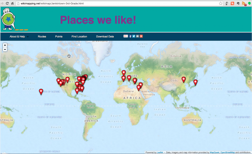
My daughter’s teacher, Mrs. Abdollahi, invited me to speak to the Jenkintown Elementary School third graders today. My goal was to share with the kids some of my favorite places and then to let them put their favorite places on the map.
Mrs. Abdollahi asked me if I took classes in college to make maps. I majored in English because my English teacher, Rich Furze, at Phillips Exeter Academy, had said that I just had to take a class with Patricia Kane, in the Macalester College English department. Macalester is in St. Paul, near the Mississippi. It so happens that Professor Kane’s brother, David Lanegran, nurtured my love for geography.
I channeled a little Lanegran into my talk
I showed the kids where they could walk across the Mississippi. I showed them the Delta. We talked about how the wind and water erodes the fields and how a lot of the dirt ends up in the Gulf of Mexico, creating Louisiana’s unique shape. We talked about how things keep changing shapes. There used to be lots of places you could walk across the Mississippi. I showed the kids a beach in the middle of the river created by dredging so that ships could safely travel north.
We talked about Old York Road and bicycling to New York City
A student asked if Old York Road crosses Pennsylvania. I said that Old York Road was a turnpike between Philadelphia and New York City. I talked about how there used to be a log (a pike) across the road and how people would have to pay to use the road. I pulled out a map of the East Coast Greenway and asked the kids if they’d like to bike to New York City. I asked if they’d be willing to bike 30 miles a day. About 20 hands went up.
Wow! All of this interest in bicycling to New York City. I was thinking about how we could get lots of parents and kids to come along.
Finally, I let the kids come up and add a point to the WikiMapping project.
Everyone in the third grade came up and told me their favorite places. I would have thought that the kids favorite places were close by. But these kids expressed an interest in places all over the world. Some were places they wanted to go. Some were places they had been. Some points were as specific as an address. Others focused on a city or state.
After adding points the map, everyone got a map to take. Of three maps, the most popular was the NE PA Hiking and Bicycling Map. This was partly because the map is plastic.
On my way out…
I stopped by and said hello to Dr. Wade, the District Superintendent. He talked about what great kids and alumni Jenkintown has. He mentioned the wonderful generosity of a alumnus who donated funds for the basketball scoreboard and the combined efforts that made the stadium scoreboard possible. And he mentioned need for a digital announcement board to go by the school tennis courts that was inspired by a gift from the Jenkintown Class of 1974.
Today is a really awesome day for me because I have had the opportunity to visit my daughter’s class. And I think that if I had put my favorite place on the map, today it would have been Jenkintown Elementary School.

