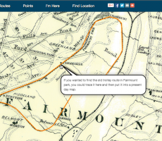
Annotating an 1899 Map
I’m going to describe how I imported an 1899 map into WikiMapping. Why do this? It’s searchable. I can trace it and bring the data into my own maps. I can highlight information to share with others. And, I just love old transit maps.
The project I’m referring to is here.
Mike Szilagyi had given me a scan of some Philadelphia trolley maps, and I don’t know if I ever put them on PhillyMap.com. Since I came across them, I thought I might put a hundred and fifteen year-old map on WikiMapping.
In QGIS, there is a georeferencing plug-in. I followed the steps in the Kindle book, Learning QGIS 2.0, which is pretty basic but still useful. I don’t think one needs much guidance. You have to load an open street map or other base as a reference. The general concept is to open an unprojected tif, click a point on the tif, and then click a point on a corresponding reference base map in Web Mercator.
There were a couple of good tips for saving the document. I used the following.
- Create, and save a ground control points file
- Tranformation: polynomial algorithm 2 (from the pull-down menu). I could have used 3, but 2 was sufficient.
- Resampling method: Cubic
- There’s an option to load the reprojected image into your project.
From here, you can create map tiles using a plugin called QTiles. If you are going to host your files on your own server, then you can use a larger zoom level. The file size limit on WikiMapping is 100 MB. For this map, I could get to a zoom of 15. A zoom of 18 was nearly a gigabyte in size.
Saving all of the levels took about 15 minutes on my Macbook Air. Speaking of which, my old laptop is powerful enough so that I can work on a 350 MB map, about 80MB of which is raster and MAPublisher data.
To sum up… I feel confident that I can get any map that I need to into WikiMapping. And by placing a destination point, I can get directions to that point and see my current location on the old map. It’s a fun way to explore history.


