wikimapping-images

Map your photos

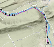
This map shows where we took photos along the D&L Trail. The Appalachian Trail bridge is just one of these photos.
As a Project Administrator, you can import the photos taken with just about any mobile phone directly onto the map, annotate them, and share them.
But just think about getting 1000 people doing something like this.
Maybe they wouldn’t provide you with photos, but they can provide you with great data to help you plan a community. We are making it easy to get and share perspectives on a map.
