
Putting the Memphis & Shelby County bike map on the web
The Memphis, TN Bicycle Map is published and available, as are several other maps that we’ve worked on over the winter.
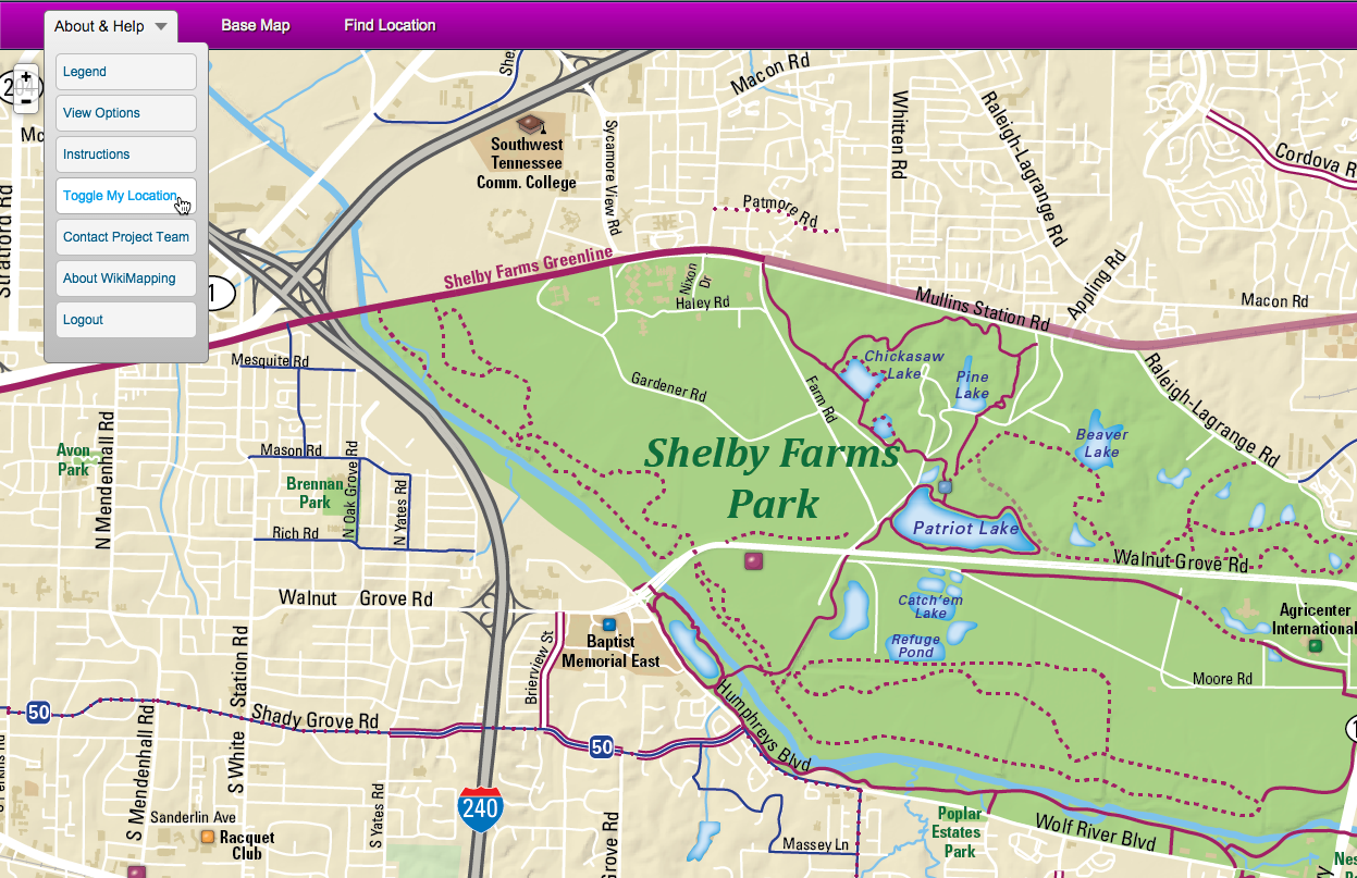
Someone using the map on a phone may have the following needs priority needs
- The ability to see one’s own location on the map. This is toggled on and off using “Toggle My Location”
- Ability to see the map at a larger scale. The print map detail doesn’t change, but the fonts get larger and easier to read.
- Access to a custom legend. This is shown directly on the map, but we are also creating a space in the menu for it.
- Custom instructions. This can be a video, but I’ve read that people prefer to learn from screen shots.
- Switching between map views. For now, this means switching between the main map and the downtown inset. We could also add other base maps, such as aerial imagery.
What’s new?
Basically, the new WikiMapping functionality is the custom legend, which is being coded as I write.
Additional functionality
We could let people draw their own routes and add notes and photos to the map. These options make the menu larger, and I thought it would be best to focus on the most important needs of the user.
Application to other projects
The custom legend should be useful to many projects that use a custom base map and the legend isn’t automated.
Finding a balance
Somebody who uses a WikiMapping a lot is likely to have different needs from a first-time user. I find this to be a repeating focus of our attention. Our core audiences are planners who need to engage the public and cartography clients who need to provide direction. We are continuing to blend the two needs to create an ongoing feedback loop between WikiMapping clients and their audiences.